

Originally shared by Pierre Markuse
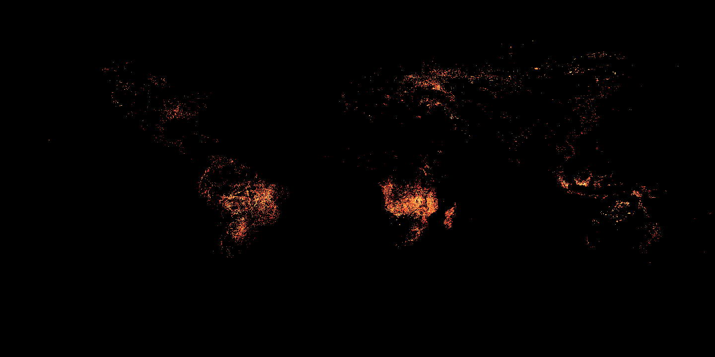
Active Fires on Earth in September 2015
In this image you can see active fires on Earth in September 2015 imaged by the Moderate Resolution Imaging Spectroradiometer (MODIS) aboard the Terra satellite. The image is color-coded, white pixels show the high end of the count — as many as 100 fires in a 1,000-square-kilometer area per day. Yellow pixels show as many as 10 fires, orange shows as many as 5 fires, and red areas as few as 1 fire in a 1,000-square-kilometer area per day.
More active fire maps and other datasets can be found here at NASA’s Earth Observation (NEO) website:
Terra (EOS AM-1) satellite
The Terra satellite is part of the Earth Observing System (EOS, https://goo.gl/XYed36), its Moderate Resolution Imaging Spectroradiometer (MODIS) can take measurements in 36 spectral bands ranging in wavelength from 0.4 µm to 14.4 µm, another MODIS instrument is orbiting Earth aboard the Aqua satellite.
More on the Terra satellite and the Moderate Resolution Imaging Spectroradiometer (MODIS) here:
https://en.wikipedia.org/wiki/Terra_(satellite)
http://modis.gsfc.nasa.gov/about/design.php
Image credit: ACTIVE FIRES SEPTEMBER 2015 (1 MONTH – TERRA/MODIS)These Fire Maps were created by Reto Stockli, NASA’s Earth Observatory Team, using data courtesy the MODIS Land Science Team at NASA Goddard Space Flight Center http://goo.gl/IQXKix
#science #earth #fire #wildfire #modis #eos #terra #spacetechnology #earthobservation